Cochran Creek Falls
Cochran Creek Falls - Dawson County, GA
Start: Blackhawk Drive
Location: Dawson County
Elevation Gain: 978ft
Distance: 6.2 mile out-and-back
Difficulty: Hard (NOT for a novice hiker)
Dog Friendly: We do NOT recommend taking your dog, though it is dog friendly.
First and foremost, this trail is tough, dangerous, and unforgiving. If you are a novice hiker, we don’t suggest this for you. This trail should only be utilized by experienced hikers. You can use the address listed in the AllTrails App however you will want to listen to our instructions closely to actually make it to the trailhead. After turning onto Blackhawk Drive, off of Dan Fowler Road, you will cross over one small creek. At this point the road splits, Keep LEFT! You will continue down the rugged dirt road until you cross a second, much deeper, creek crossing. This crossing is helpful to do with a 4x4 vehicle. In fact, we suggest taking a 4x4 vehicle to get to the trailhead. Though, it may not be necessary, it will make your life easier. After crossing the second stream the road forks again, at this point Keep RIGHT. You will come to a 3rd creek crossing with what appears to be parking area. Across the stream you will notice bolders blocking the path so that vehicles cannot cross. Park your vehicle PRIOR to the 3rd creek crossing. You will do this one by foot.

After crossing the creek, you will follow what appears to be an old service road. You will stay on this road, with the creek to your left, for just under 2 miles. This portion of the hike isn't very scenic and is relatively flat. After crossing over the tree pictured below, the trail will then turn into more of a single track trail and you will begin gaining elevation.

This trail is incredibly poorly marked. From time to time, you will catch a glimpse of what appears to be a tiny pushpin that will let you know you are going the right direction. However, do not rely on these as many trees that they were on have fallen. The orange marker below is what we are talking about.

There are some sections where you can step off of the trail and into the creek nearby. This area of the trail is gorgeous. This would be a safe place to take a break before you begin the last two tenths of a mile to the falls.

At this point in the trail, be prepared to navigate over and underdown trees on a very narrow and steep hillside. It can be dangerous so take this section slow. This last section of the hike is incredibly steep and there is not a great place to take a break. This section does not last long but it will take your breath away.

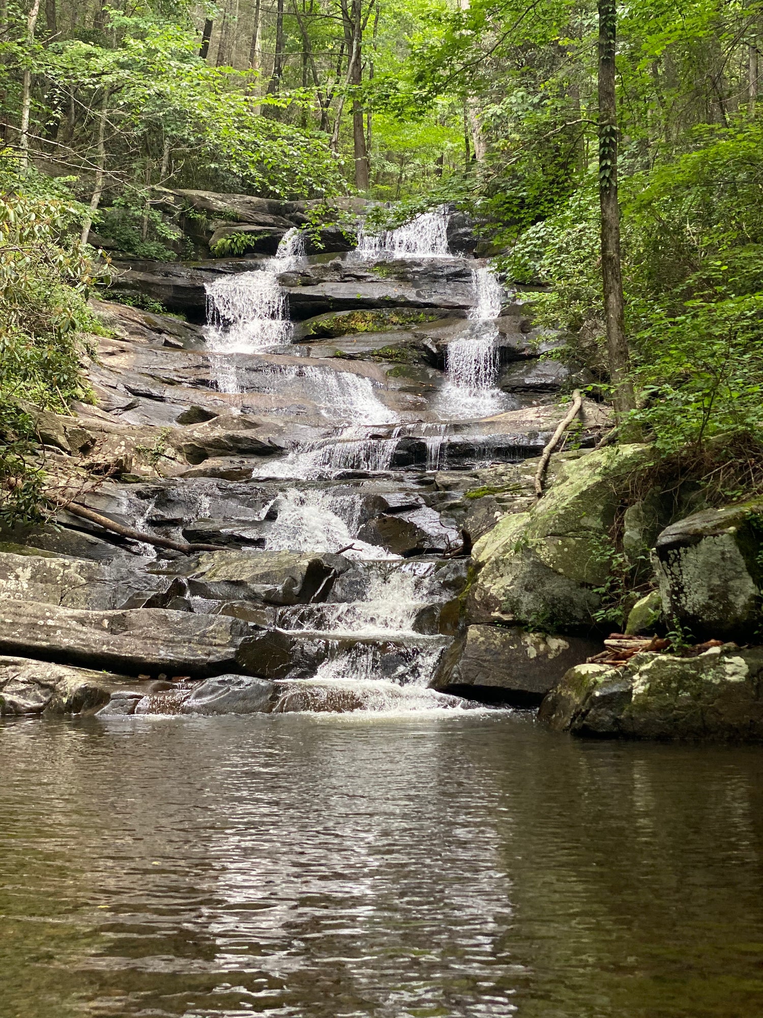
After braving the brief, muddy, steep section to the falls, you will come to a flat perfect for having lunch and admiring these amazing falls.


Also, there is a narrow, steep trail to the right side of the falls that will lead to the top of the falls. This lookout over the falls is difficult and dangerous to get to, especially if it has rained. We were unable to access it the last two times we went.
WE NEVER SUGGEST HIKING ALONE. TAKE GPS, A FRIEND, AND DO NOT SEPARATE FROM YOUR GROUP.
Find Your Sense of Adventure